Tornado With 95 MPH Winds Injures 5, Leaves 5-Mile Path Of Destruction Through Culpeper County Tornado With 95 MPH Winds Injures 5, Leaves 5-Mile Path Of Destruction Through Culpeper County Tornado With 95 MPH Winds Injures 5, Leaves 5-Mile Path Of Destruction Through Culpeper County
Tornado With 95 MPH Winds Injures 5, Leaves 5-Mile Path Of Destruction Through Culpeper County Five people were injured in a tornado that wreaked havoc across Culpeper County on Sunday night, May 26, according to the National Weather Service. The twister that began as a severe thunderstorm developed into a tornado in Rixeyville at 9:27 p.m., reaching winds up to 95 miles per hour, the NWS said. The tornado touched down along Dunkard Church Road, snapping and uprooting trees in multiple directions. The tornado proceeded east- northeast and crossed Eggbornsville Road. In this area, two dozen trees were also snapped and uprooted in multiple directions. The torn…
'Declaration Of Disaster': Tornado Touches Down In Central PA 'Declaration Of Disaster': Tornado Touches Down In Central PA 'Declaration Of Disaster': Tornado Touches Down In Central PA
'Declaration Of Disaster': Tornado Touches Down In Central PA A tornado touched down in Mahanoy City, Schuylkill County on Monday night, May 27, according to officials.  The twister was first reported on the west side of town., Mahanoy fire officials said. By 10 p.m., the borough had issued an official declaration of disaster and all residents were ordered to stay indoors.  THE BOROUGH OF MAHANOY CITY HAS ISSUED A DECLARATION OF DISASTER, ALL RESIDENTS SHOULD REMAIN IN THEIR HOMES. Posted by Borough of Mahanoy City on Monday, May 27, 2024 The American Red Cross set up a shelter at the Citizens Fire Company for displaced residents within the hour. …
Tornado Watch Issued For Parts Of Maryland Tornado Watch Issued For Parts Of Maryland Tornado Watch Issued For Parts Of Maryland
Tornado Watch Issued For Parts Of Maryland A Tornado Watch has been issued by the National Weather Service for parts of Maryland. An alert was issued on Wednesday, April 3 advising that Calvert, St. Mary's and King George counties will be under the Tornado Watch until 7 p.m.  Severe thunderstorms are expected to begin forming between 2 p.m. and 6 p.m. on Wednesday, bringing whipping, potentially damaging winds, with large hail possible in parts of the area. 2:03pm-A line of strong thunderstorms continues to push north from the northern neck of VA into southern MD over the next 1-2 hrs. Damaging winds, & hail will accomp…
Tornado Touched Down In NY For Only Second Time Ever In February: Here's Where Tornado Touched Down In NY For Only Second Time Ever In February: Here's Where Tornado Touched Down In NY For Only Second Time Ever In February: Here's Where
Tornado Touched Down In NY For Only Second Time Ever In February: Here's Where A tornado touched down in New York during a potent storm packed with damaging gusty winds accompanying a cold front last week, the National Weather Service has announced. A damage survey determined the timing to be around 5:20 p.m. Wednesday, Feb. 28 in Broome County about 10 miles north of Binghamton in the hamlet of Castle Creek. It had an estimated maximum wind speed of 100 miles per hour. The tornado tracked 0.61 miles, with a width of 150 yards. The twister was rated an EF-1 on the Enhanced Fujita scale, the second-weakest of the six levels. Related story - 72 MPH Wind…
Tornado Possible, Flood Watch Issued Across 18 NJ Counties As Thunderstorms Loom Tornado Possible, Flood Watch Issued Across 18 NJ Counties As Thunderstorms Loom Tornado Possible, Flood Watch Issued Across 18 NJ Counties As Thunderstorms Loom
Tornado Possible, Flood Watch Issued Across 18 NJ Counties As Thunderstorms Loom A flood watch is in effect across 18 of New Jersey's counties as thunderstorms with the possibility of a tornado moves in, the National Weather Service said. The flood watch is in effect until Wednesday evening, Sept. 13, in the following counties, according to the NWS: Bergen, Burlington, Camden, Essex, Gloucester, Hudson, Hunterdon, Mercer, Middlesex, Monmouth, Morris, Ocean, Passaic, Salem, Somerset, Sussex, Union and Warren. The NWS said there is a "marginal risk" of an isolated tornado and damaging winds, however, no tornado watch or warning was issued. A flood watch is in effec…
Twister Touch Down: Tornado Confirmed In Eastern PA By NWS Twister Touch Down: Tornado Confirmed In Eastern PA By NWS Twister Touch Down: Tornado Confirmed In Eastern PA By NWS
Twister Touch Down: Tornado Confirmed In Eastern PA By NWS A tornado touched down in northeastern Pennsylvania on Saturday, Aug. 12, uprooting trees and reaching wind speeds as high as 105 miles per hour, according to the National Weather Service.  The storm, now a confirmed twister, carved a three-mile path through Nescopeck Township, Luzerne County around 4:30 p.m., meteorologists at the NWS Binghamton, New York Station said.  An additional storm survey was completed earlier today for the August 12th storms. An EF-1 tornado was confirmed in Nescopeck Township in Luzerne County, PA. #PAwx pic.twitter.com/ka4gRjnuxk — NWS Binghamton (@NWSBingha…
Tornado Touches Down In Connecticut Town Tornado Touches Down In Connecticut Town Tornado Touches Down In Connecticut Town
Tornado Touches Down In Connecticut Town A weak tornado touched down in Connecticut during an intense thunderstorm over the weekend. The twister touched down in Litchfield County in the town of Roxbury around 9 p.m. Saturday, Aug. 12, and lasted for about five minutes, said the National Weather Service. Rated as an EF-0, the weakest on the Enhanced Fujita scale, the damage included large broken tree limbs that started along Minor Bridge Road and moved northwest and uphill before ending near Town Line Road, the weather service said. To gauge the damage, the weather service met with eyewitnesses, a farm manager, and a drone pilot w…
Large Hail, Tornado Possible In DMV Region As Thunderstorms Return To The Area Large Hail, Tornado Possible In DMV Region As Thunderstorms Return To The Area Large Hail, Tornado Possible In DMV Region As Thunderstorms Return To The Area
Large Hail, Tornado Possible In DMV Region As Thunderstorms Return To The Area Just as the region cleaned up from last week's rash of thunderstorms, a new batch of severe weather is heading toward the region. Whipping winds approaching 70 mph are possible along with a chance of a tornado, hail, and flash flooding potentially hitting some parts of Washington, DC, Maryland, and Virginia on Monday, Aug. 14, forecasters are advising. Hot and humid air paired with an approaching warm front will result in thunderstorms later today. Some storms may become severe, with damaging winds, large hail, and an isolated tornado all possible threats. #DCwx #MDwx #VAwx #WVwx pic.tw…
2 Tornadoes Touched Down In South Jersey: NWS 2 Tornadoes Touched Down In South Jersey: NWS 2 Tornadoes Touched Down In South Jersey: NWS
2 Tornadoes Touched Down In South Jersey: NWS The National Weather Service has confirmed that two tornadoes touched down in South Jersey on Thursday, Aug. 10. One in the tornades was confirmed in the Browns Mills section of Pemberton Township in Burlington County. A second one was confirmed in East Greenwich Township in Gloucester County).  More details including the EF rating/intensity were expected later. The weather service issued a tornado warning Thursday afternoon for parts of Burlington and Ocean counties.
Triple Twister Touch Down: Tornadoes Confirmed By NWS In Pennsylvania Triple Twister Touch Down: Tornadoes Confirmed By NWS In Pennsylvania Triple Twister Touch Down: Tornadoes Confirmed By NWS In Pennsylvania
Triple Twister Touch Down: Tornadoes Confirmed By NWS In Pennsylvania Three tornadoes have been confirmed to have touched down in Central Pennsylvania on Monday, Aug. 7, the National Weather Service confirmed on Friday, Aug. 18, 2023.  According to NWS, the first tornado started near the south side of North Church Street in Black Rock around 5:02 p.m. and ended around 5:05 p.m. near Glenville Road. The EF1 tornado's 105 MPH winds damaged trees along its 75-yard path, NWS explained. There was also property damage reported due to the falling trees, such as a collapsed outbuilding and a fallen roof on Glenville Road.  The second to…
Twister Touchdown: Tornado Confirmed In This Western NJ Town Twister Touchdown: Tornado Confirmed In This Western NJ Town Twister Touchdown: Tornado Confirmed In This Western NJ Town
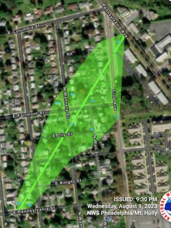
Twister Touchdown: Tornado Confirmed In This Western NJ Town Several Lehigh Valley and Delaware River towns had their own real-life "Twister" on Monday, August 7. New Jersey: According to the National Weather Service, a small EF-0 tornado appeared in Holland Township, NJ from 7:37 p.m. to 7:38 p.m. The tornado reached peak winds of 85 mph and had a path length of .52 miles. Wrapping up some of the storm surveys conducted for the severe weather that impacted the area on Monday, here is a... Posted by US National Weather Service Philadelphia/Mount Holly on Thursday, August 10, 2023 The twister started along Reiglesville — Milford Road and caused …
Tornado Touched Down In NY During Round Of Severe Storms Tornado Touched Down In NY During Round Of Severe Storms Tornado Touched Down In NY During Round Of Severe Storms
Tornado Touched Down In NY During Round Of Severe Storms A tornado touched down in New York State during a round of severe storms this week, the National Weather Service has announced following a survey of the damage. It traveled 11 miles northeasterly in Cortland and Tompkins counties from 5:13 p.m. to 5:36 p.m. Monday, Aug. 7. Its highest wind speed was 90 miles per hour and its maximum width was 200 yards as it moved from the town of Harford in Cortland County to the village of McGraw in Tompkins County. (Click on the second image above to view the path.) The twister was rated an EF-1 on the Enhanced Fujita scale, the second-weakest of th…